Roads
We design motorways, state roads, urban streets, railway lines, and other transport infrastructure structures and their equipment, applying the latest technical standards and traffic analyses. Our goal is to design safe, efficient, and long-term sustainable transport infrastructure.
The activities of IPZ primarily cover civil engineering structures, including:
Highways
State and regional roads
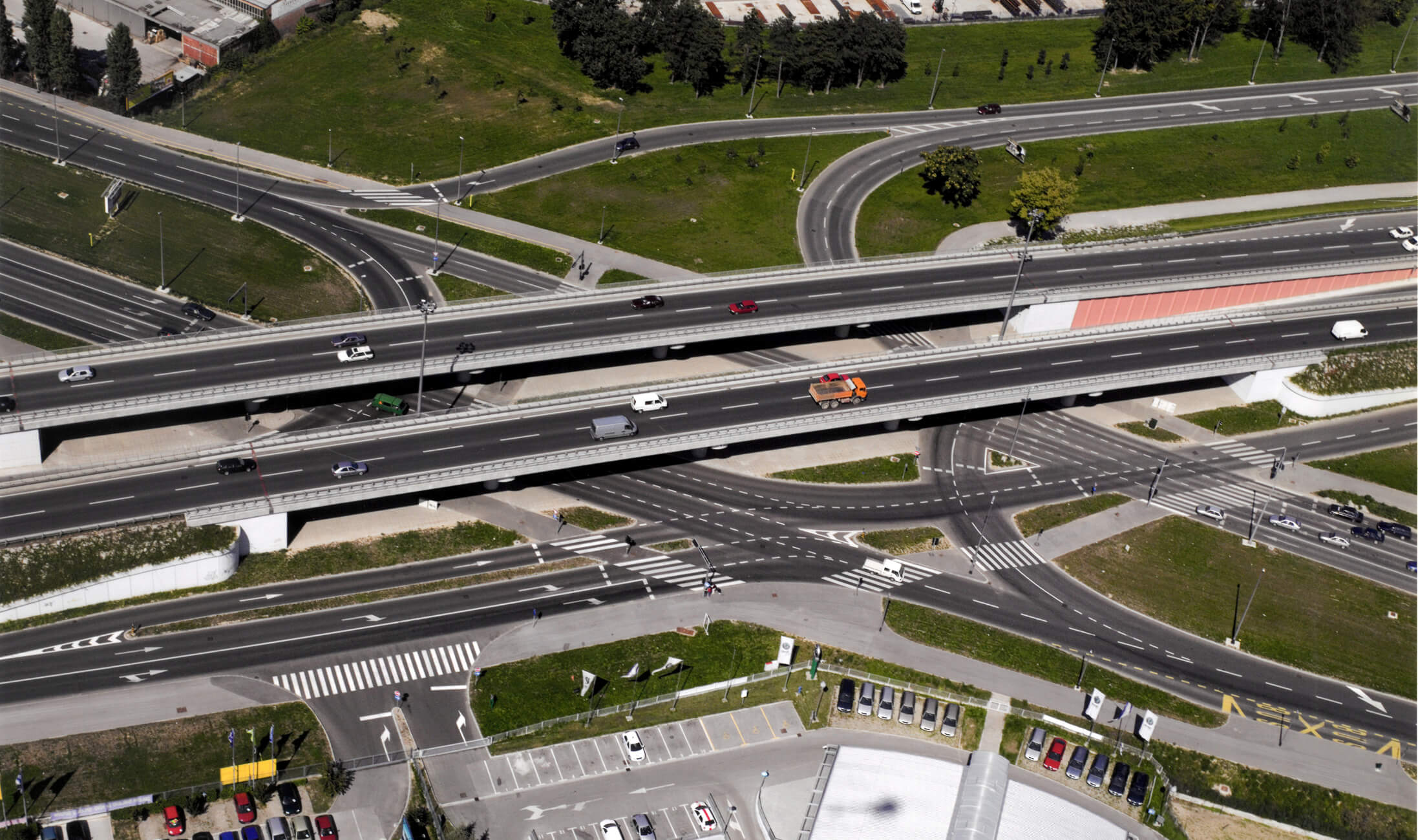
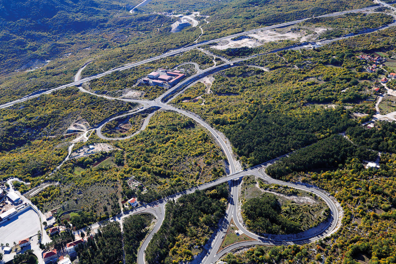
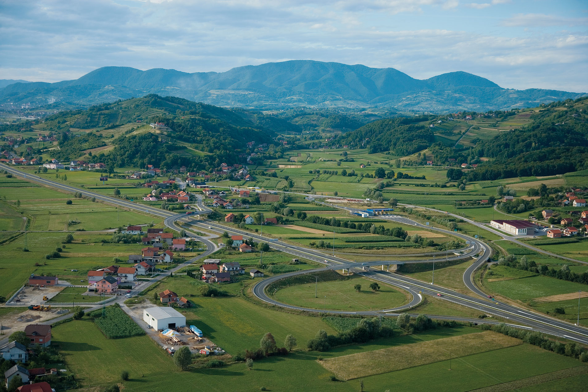
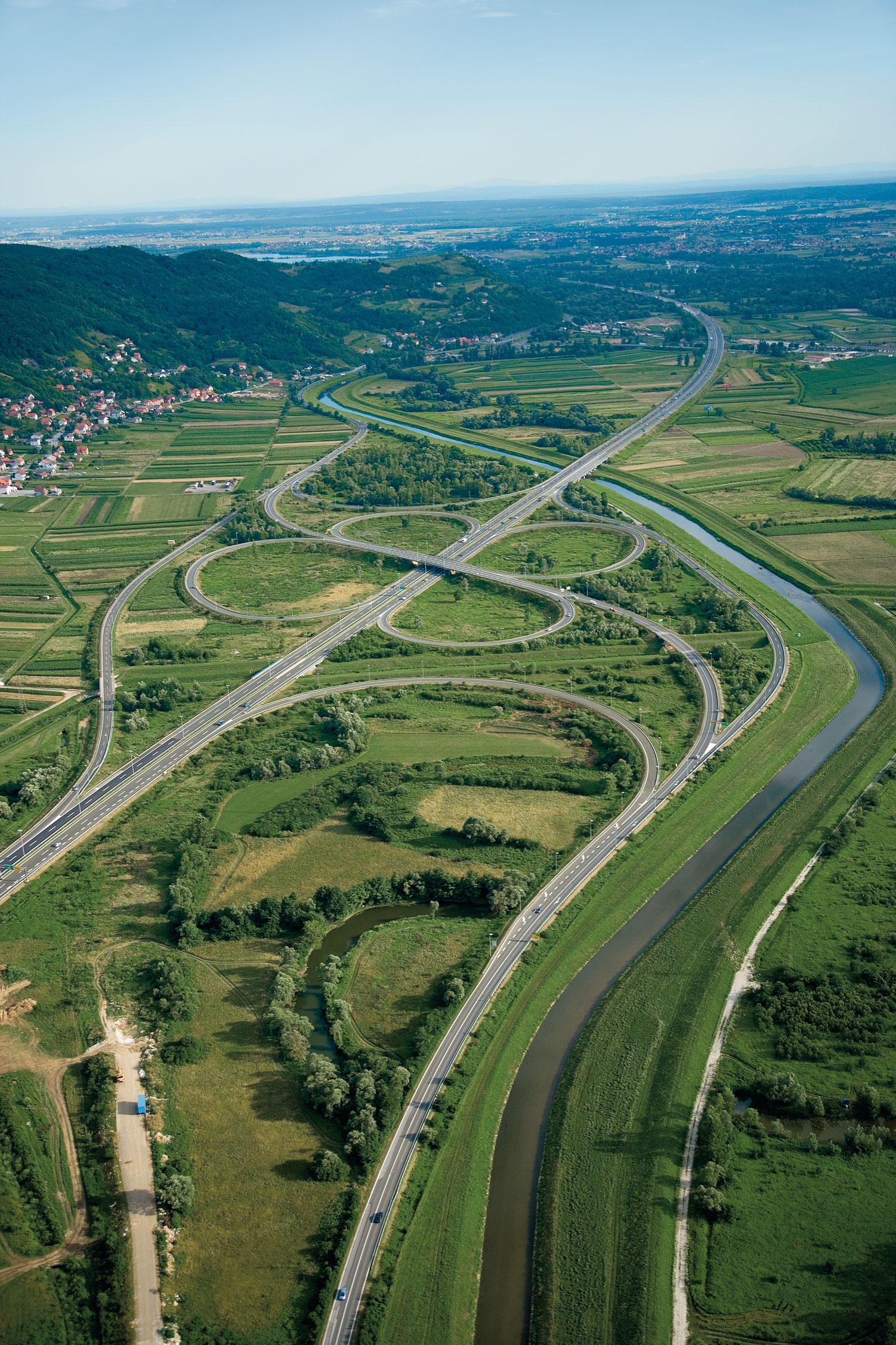
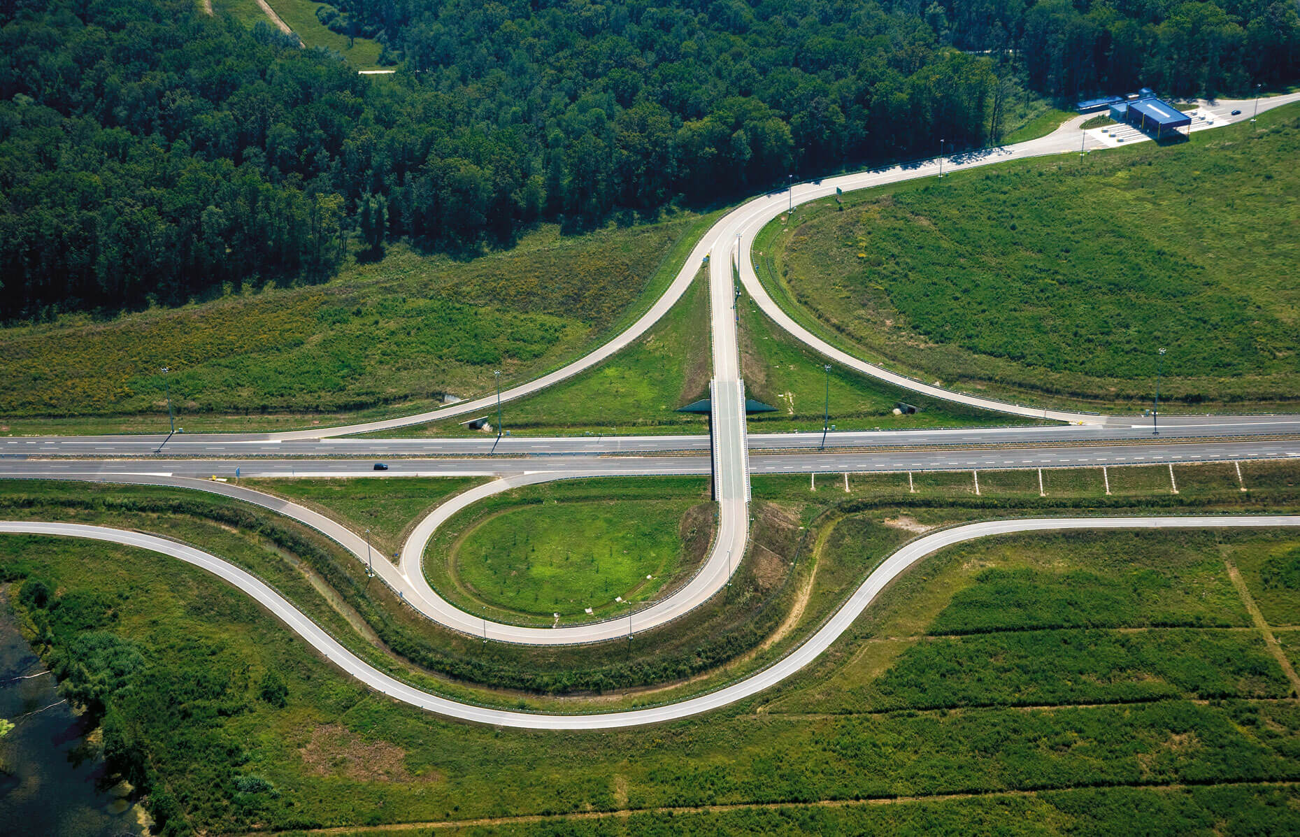
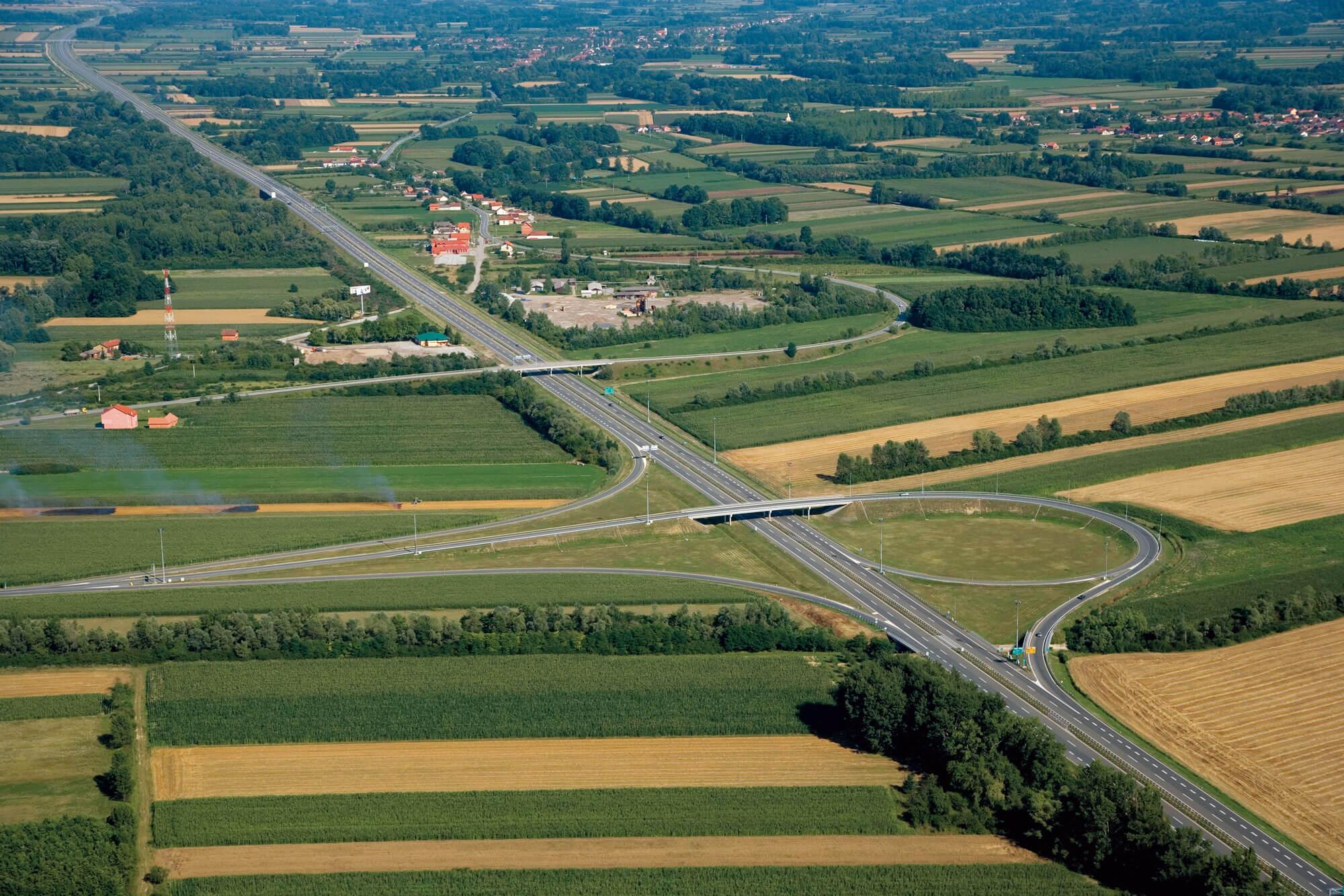
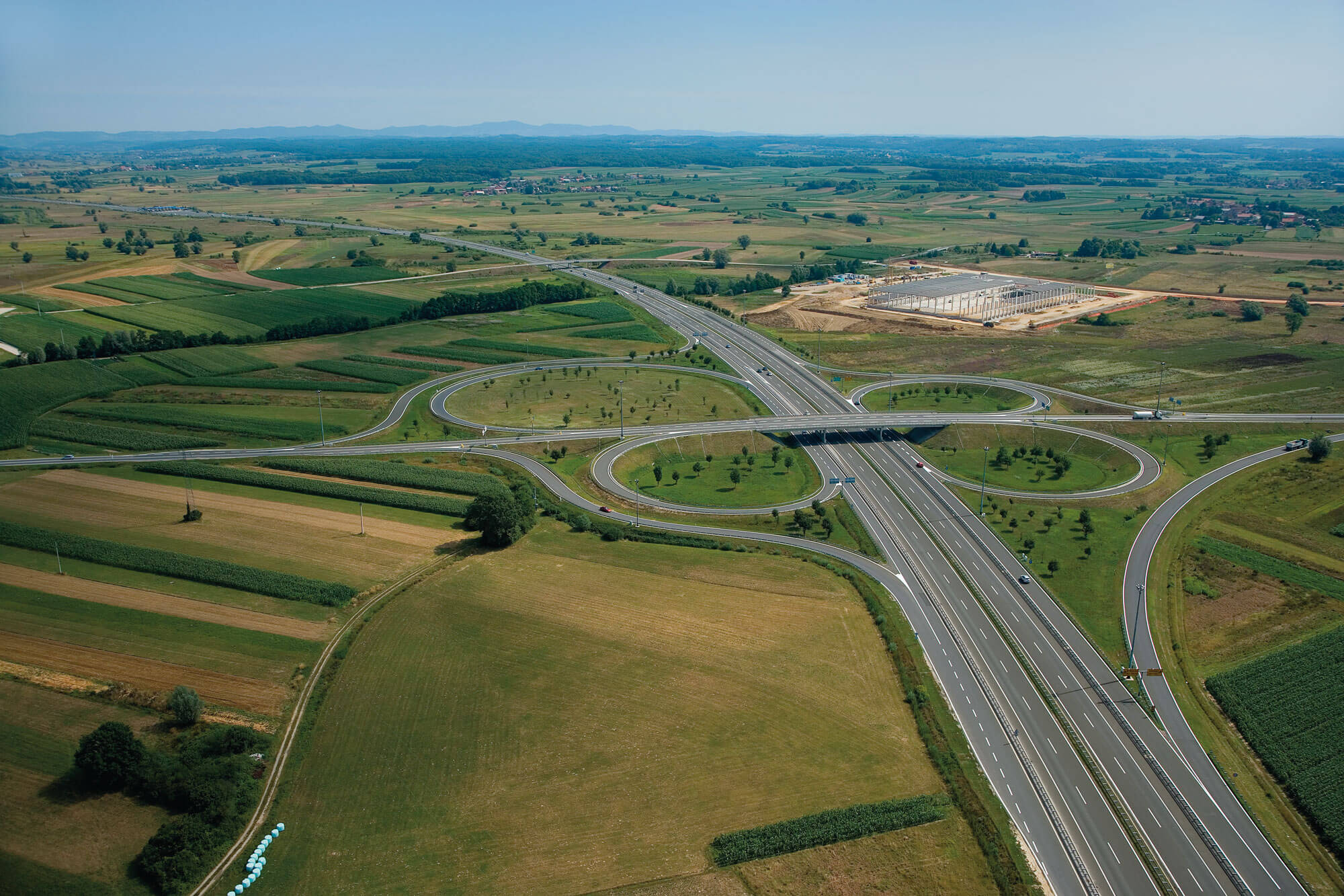
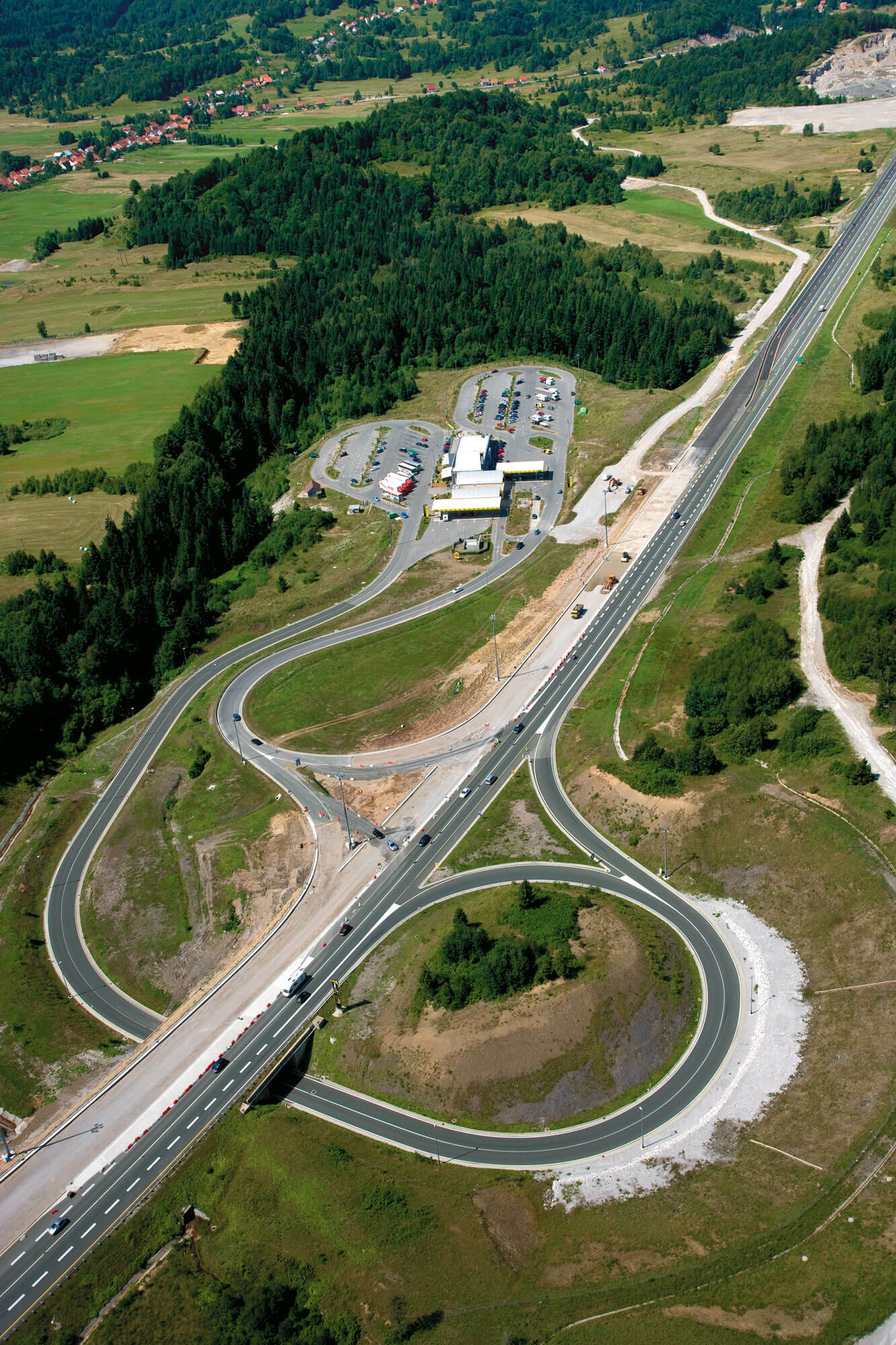
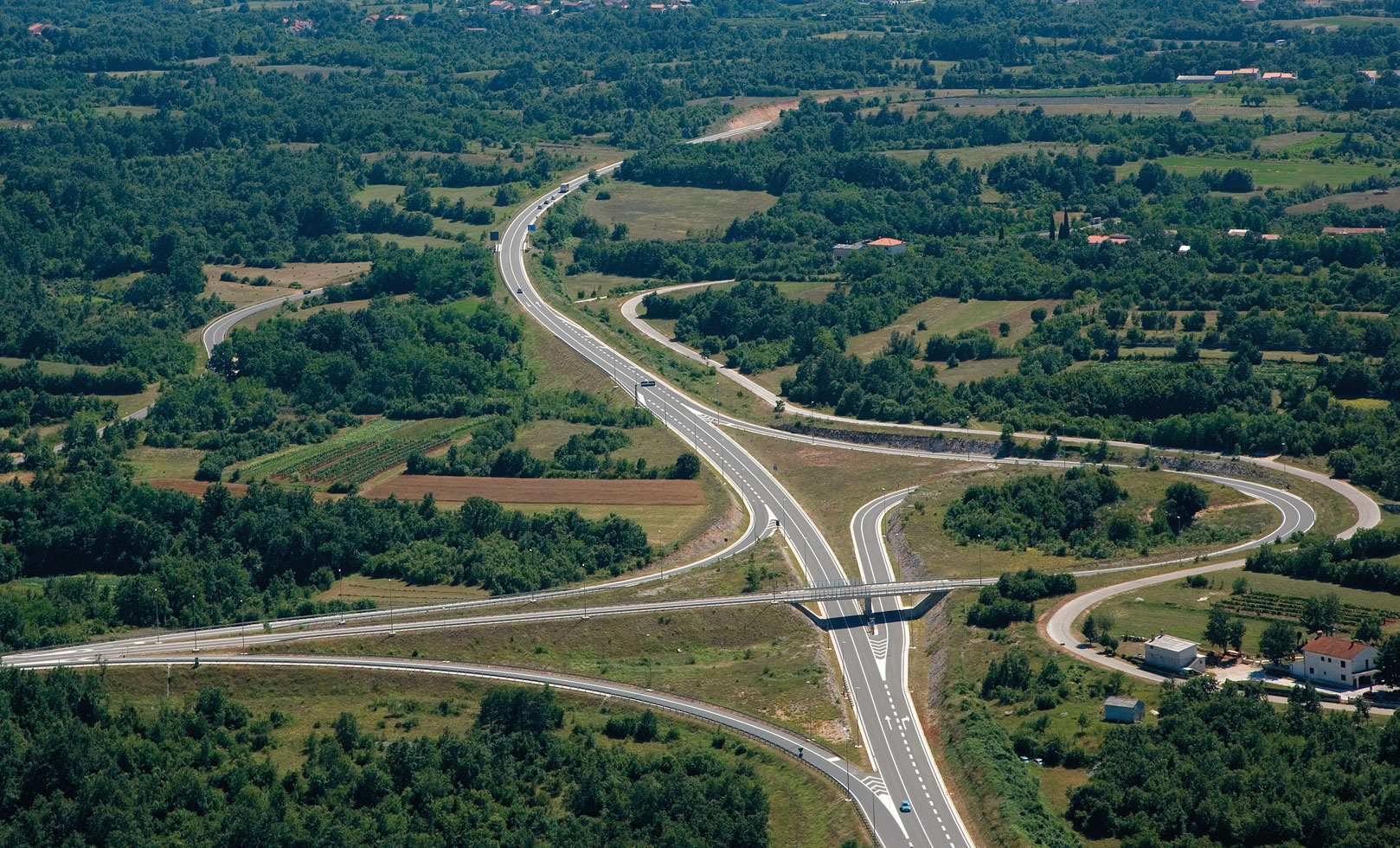
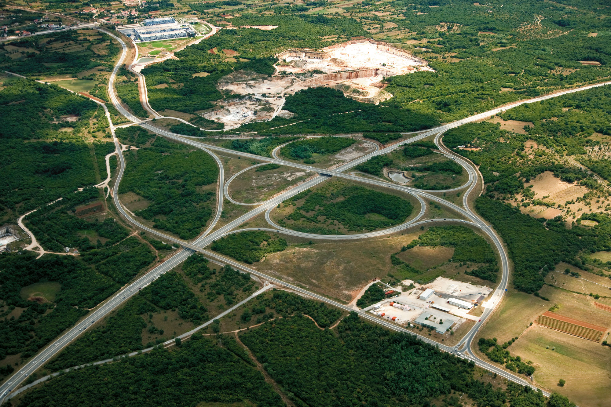
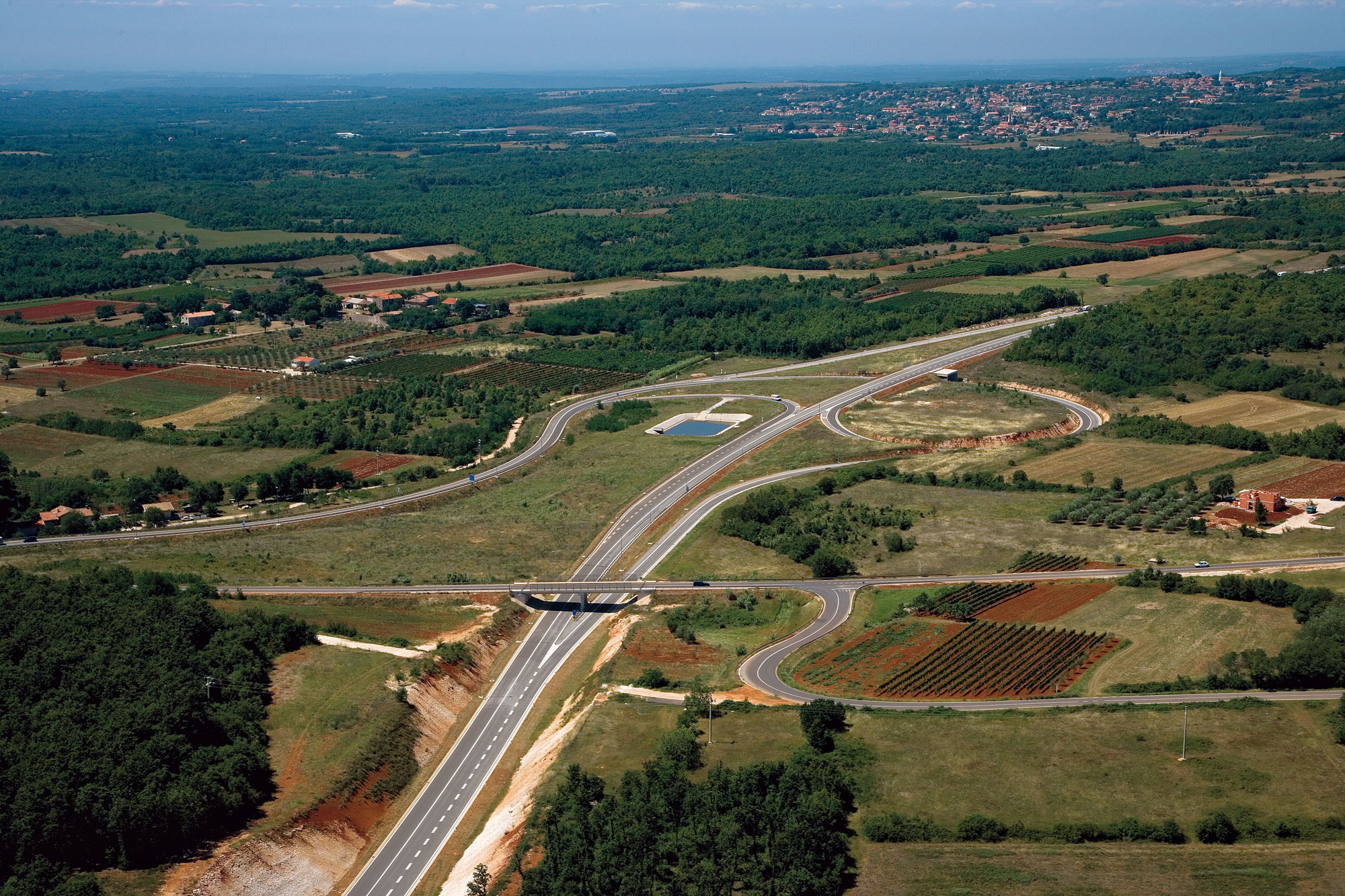
Interchanges
- interregional interchanges between two highways or expressways
- trumpet-type interchanges – highway entry/exit
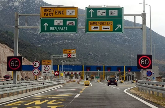
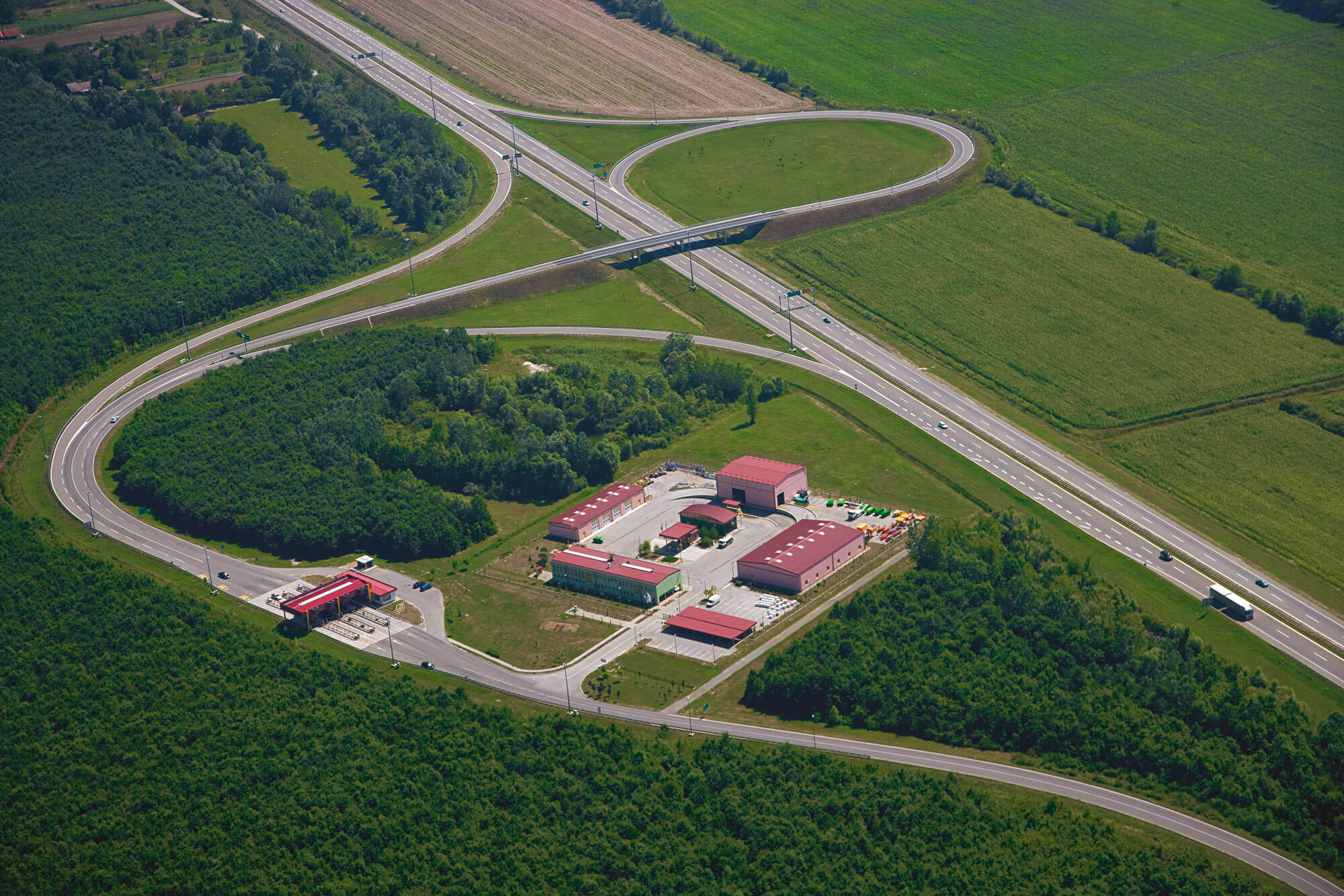
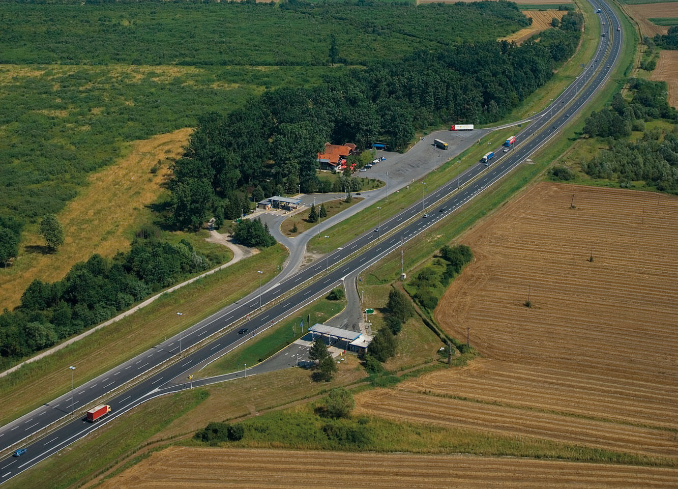
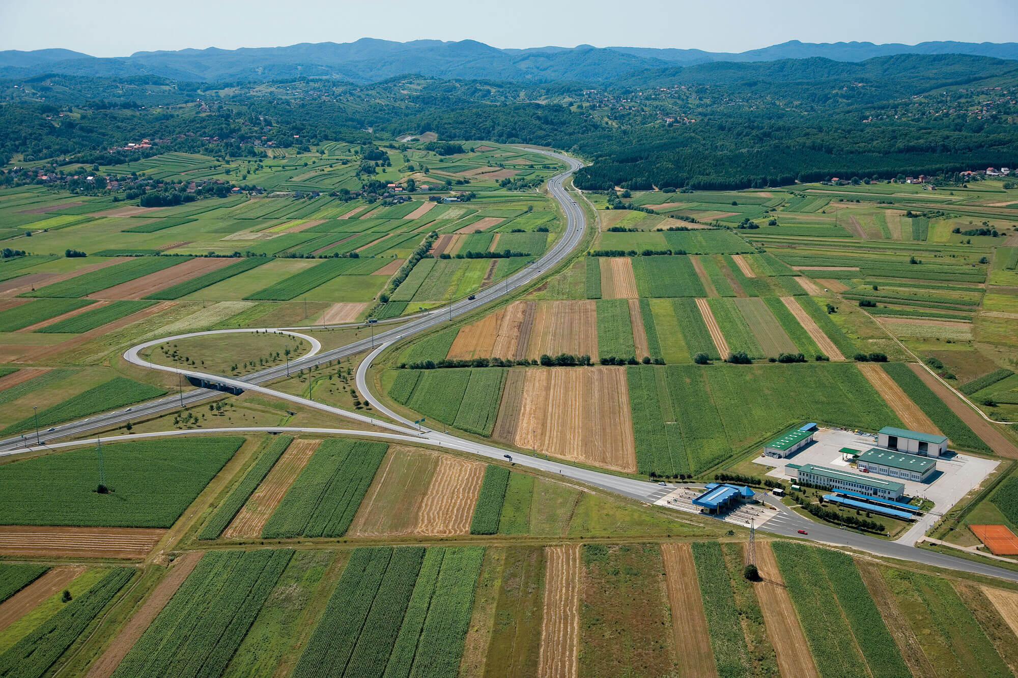
Toll stations
Closed toll system
- mainline toll stations
- toll stations at interchanges
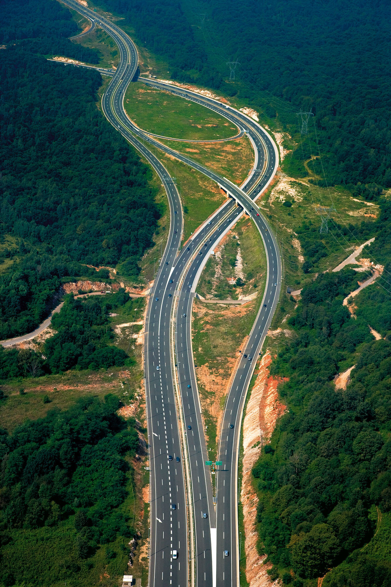
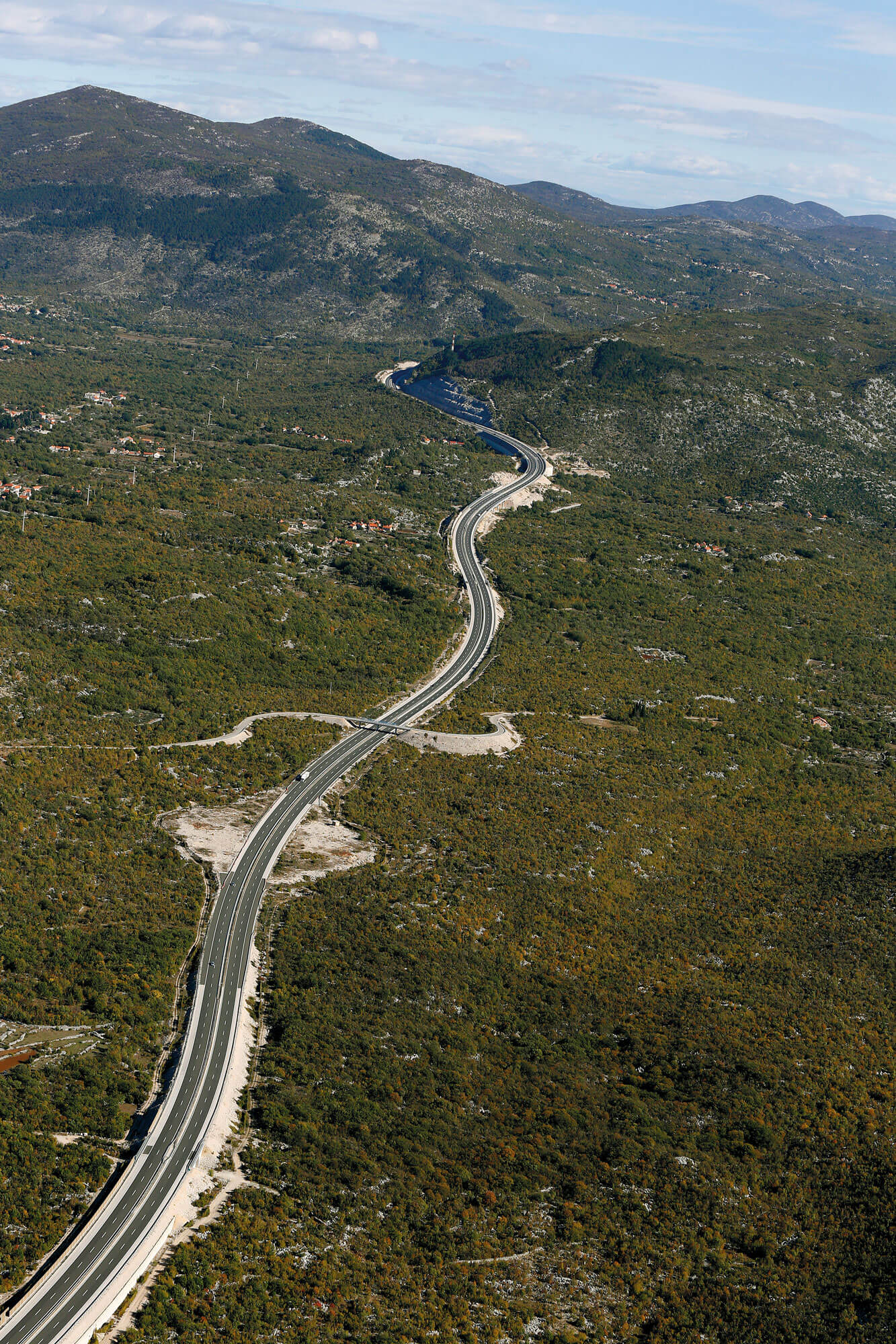
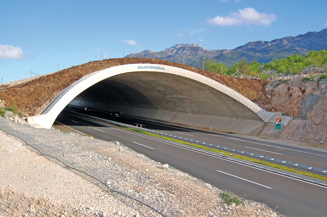
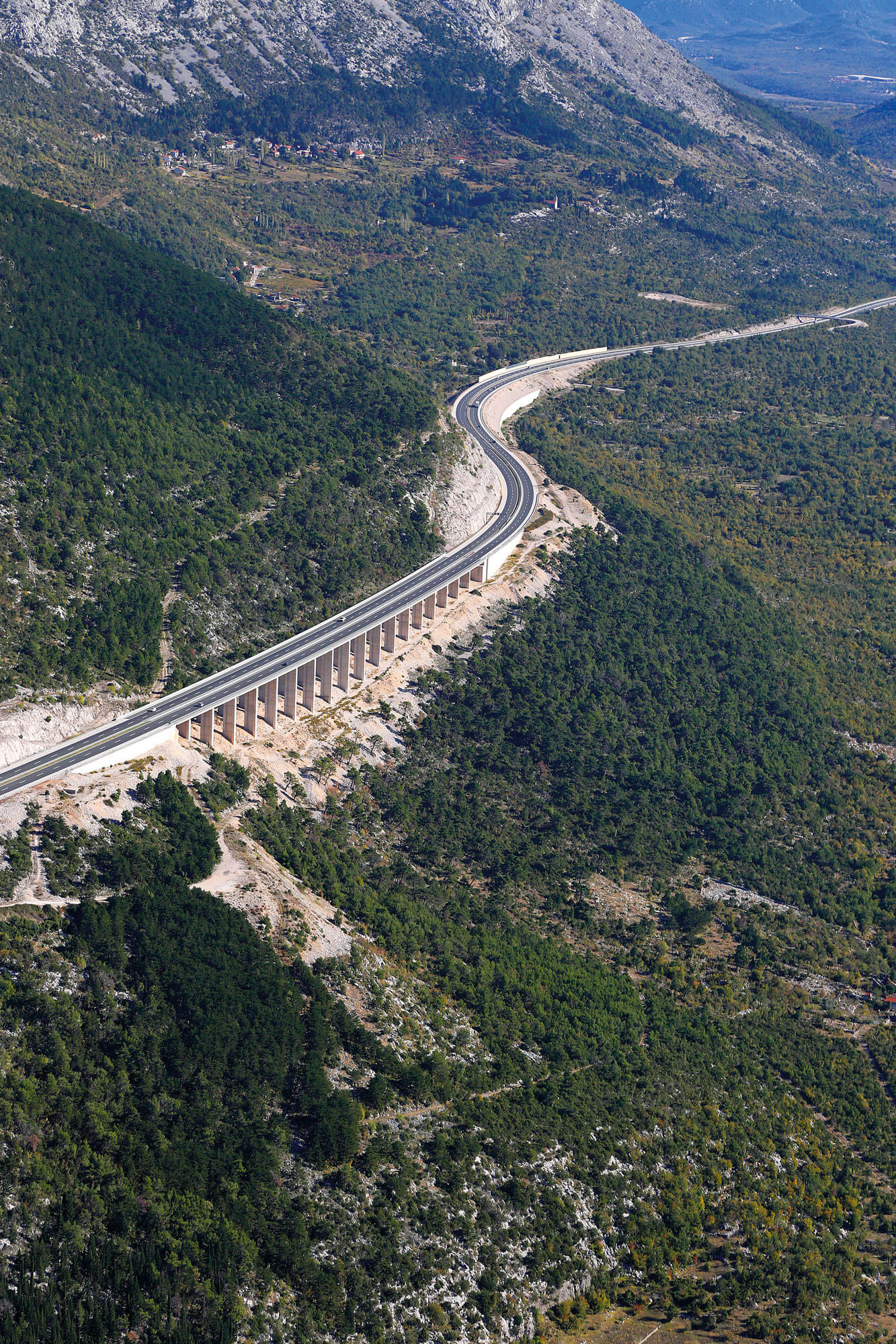
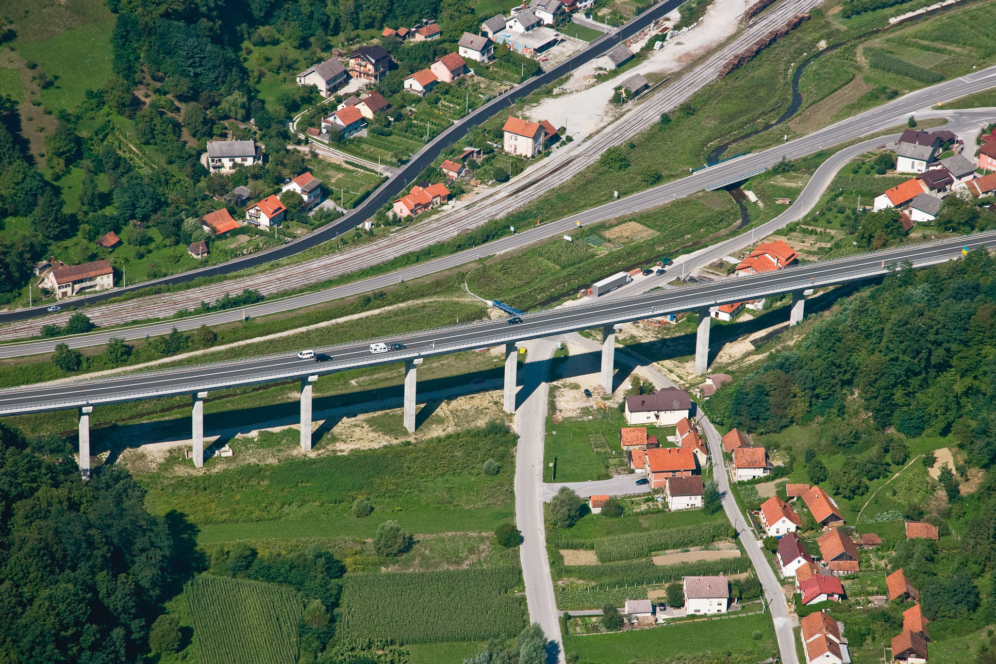
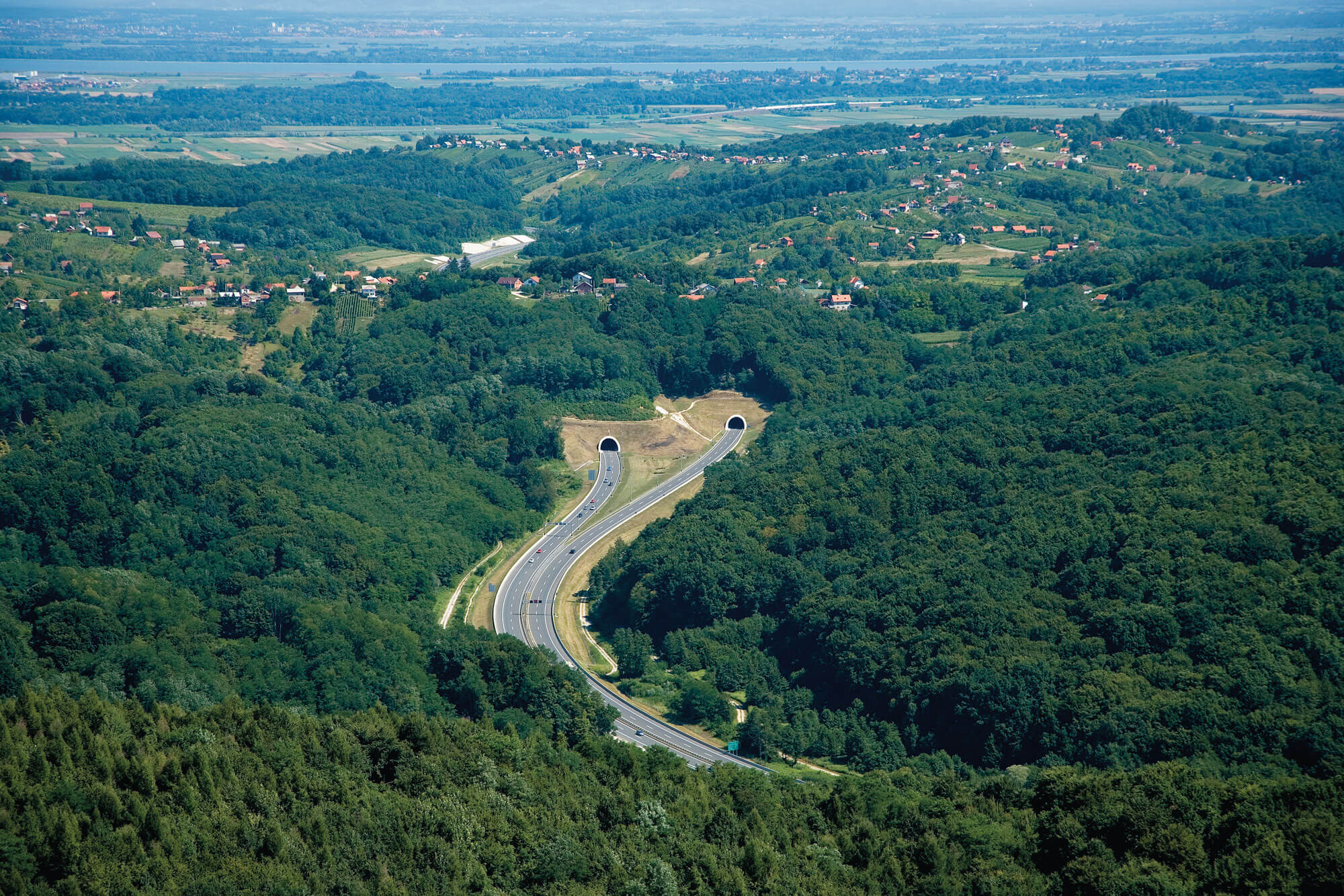
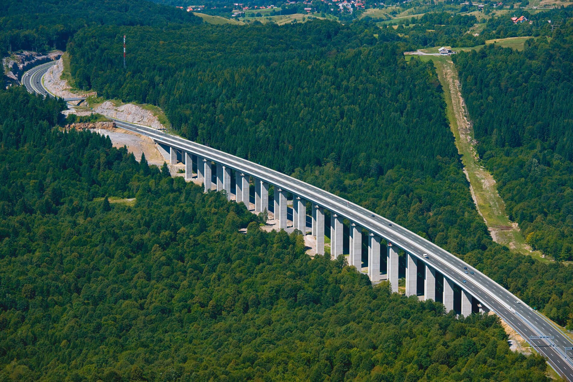
Highway A1: Zagreb – Split – Dubrovnik
Sections: Bosiljevo – Josipdol; Žuta Lokva – Otočac; Benkovac – Pirovac; Skradin – Šibenik; Šestanovac – Zagvozd; Zagvozd – Ravča
Total section length: 134 km
Highway A1 is the longest and most significant motorway in Croatia, forming the backbone of the national road network. It connects the capital city of Zagreb with Dalmatia and is crucial for the economy, tourism, and balanced regional development.
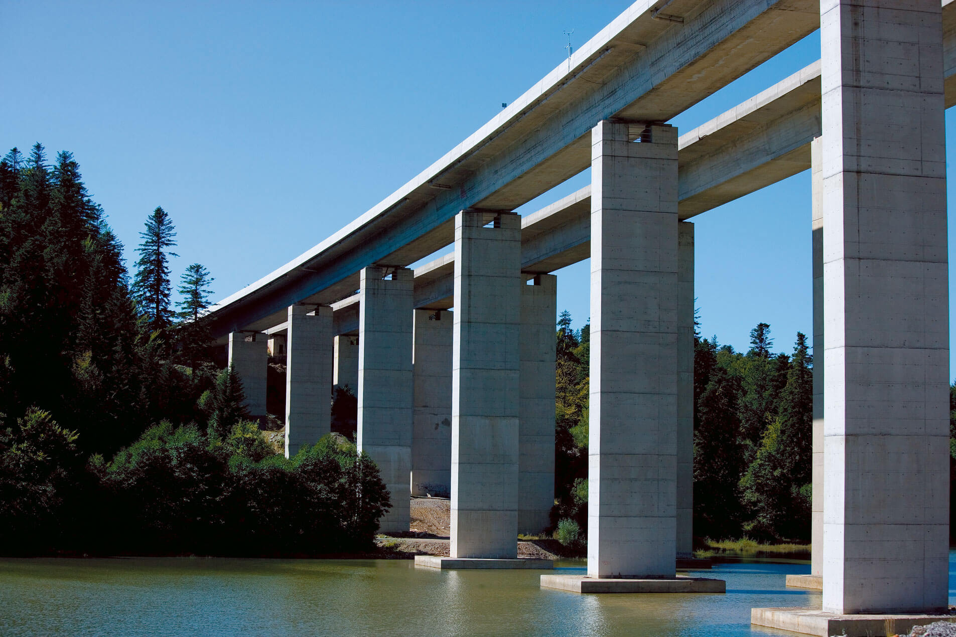
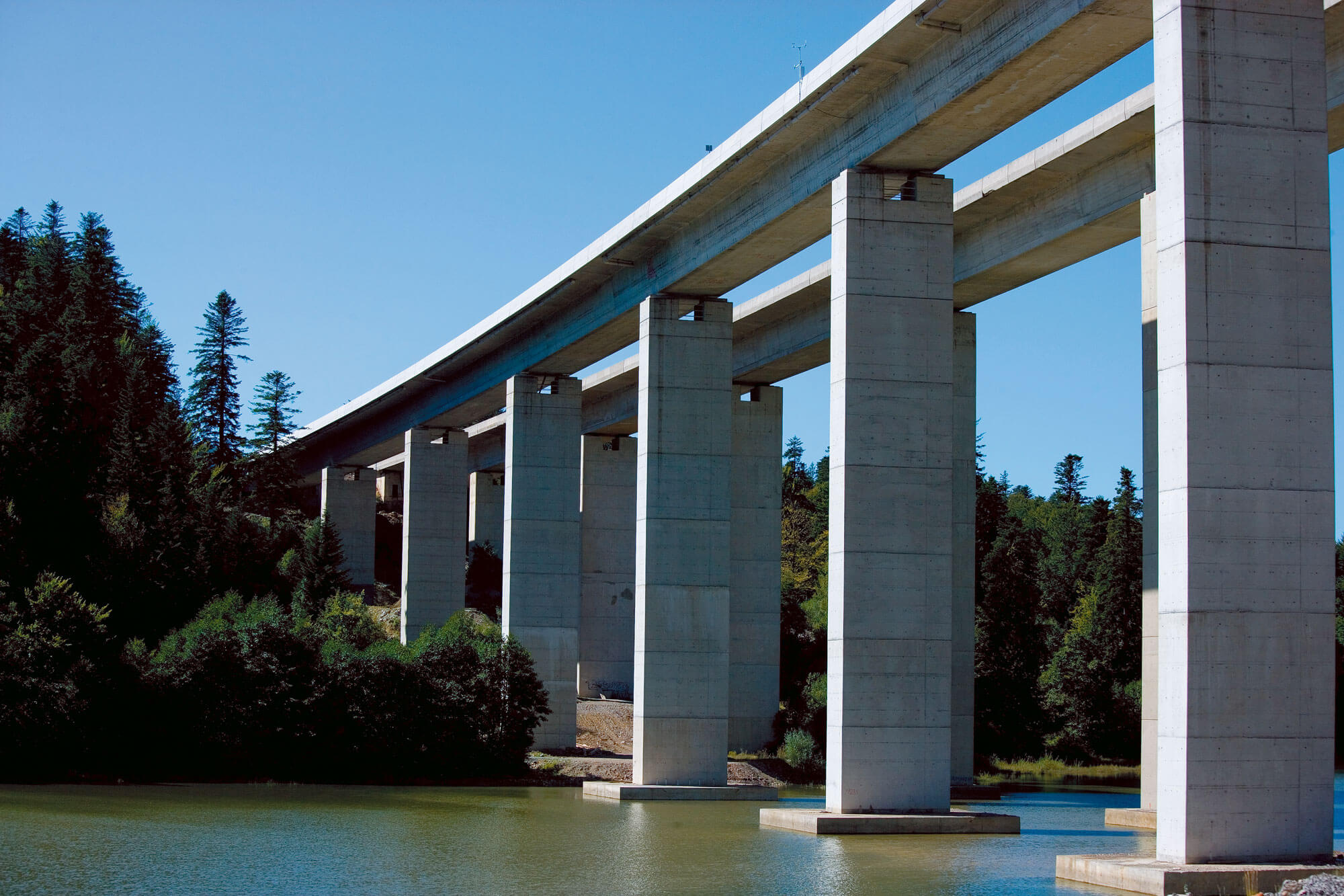
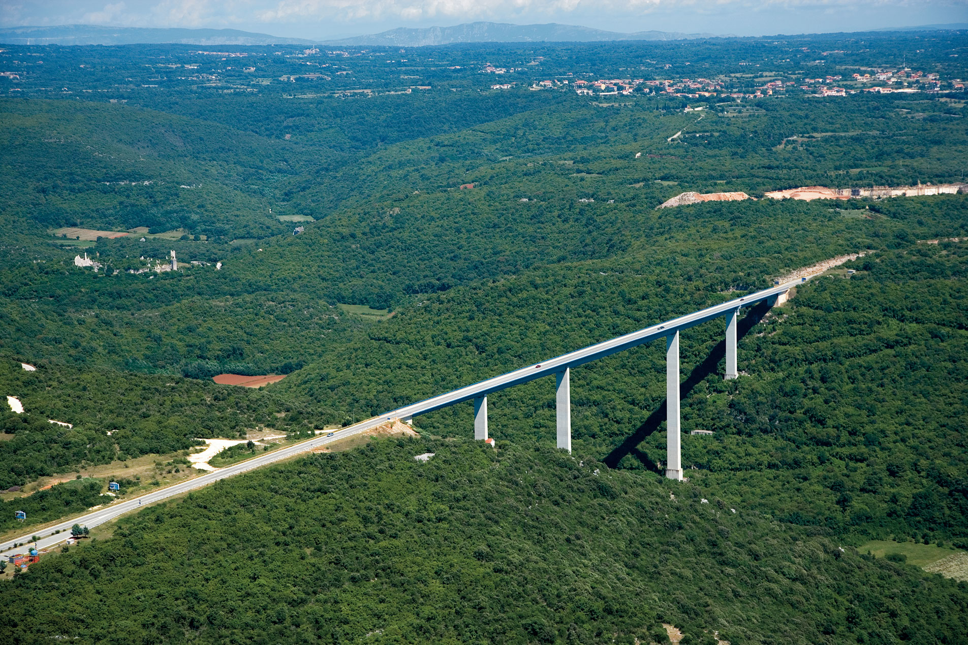
The A1 passes through highly diverse terrain – from the lowlands of central Croatia, across the mountainous regions of Lika and Gorski Kotar, to the karst areas of Dalmatia. Along the route, there are more than 400 structures (bridges, viaducts, tunnels).
The route features numerous bridges, viaducts, and tunnels, the most notable being the “Dobra” viaduct on the “Bosiljevo – Josipdol” section, the “Plasina” tunnel and “Oreškovići” viaduct on the Žuta Lokva – Otočac section, the Krka rest area and “Draga” viaduct on the Skradin – Šibenik section, and the “Rašćane” viaduct on the Zagvozd – Ravča section.
CLIENT: Croatian Motorways
Highway A2: Krapina - Macelj
Total section length: 60 km
Highway A2 is part of the international road corridor connecting Zagreb with the Slovenian border at Macelj and further toward Maribor, Graz, and Vienna. As such, A2 is crucial for connecting Croatia with Central Europe and pan-European corridors. It links Croatia with Central European markets and major European transport routes, enabling faster and safer traffic toward Slovenia and Austria. It also plays a key role in tourism, as many visitors from Central Europe use this route to reach Croatia.
The most significant structures include the “Krapina” viaduct, “Đurmanec” viaduct, and “Sveta Tri Kralja” tunnel.
CLIENT: AZM
Highway A3: Zagreb – Lipovac
Total section length: 260 km
Highway A3, also known as the Slavonian Motorway, is the most important east–west route in Croatia and part of the international Pan-European Corridor X. It connects Slovenia and Western Europe with eastern Croatia and Serbia, and thus Central and Southeastern Europe.
The first sections were built in the 1970s as part of the former Brotherhood and Unity Highway (Ljubljana – Zagreb – Belgrade). By the 1990s, almost the entire route through Croatia was completed. After the Homeland War, it was reconstructed and modernized, and in 2007 it was fully opened to traffic as a complete motorway profile.
A3 passes through the predominantly flat landscapes of Posavina and Slavonia, providing excellent driving conditions. Numerous rest areas are located along the route, and the road is characterized by heavy traffic, especially transit freight traffic toward Serbia and Southeastern Europe.
CLIENT: Croatian Motorways
Highway A4: Sveta Helena (Zagreb) – Varaždin – Goričan
Sections: Sv. Helena – Varaždin and Novi Marof – Goričan
Total section length: 60 km
Highway A4 is a key northern route in Croatia, connecting the capital city Zagreb with the Međimurje region and the Goričan border crossing toward Hungary. It is part of the Pan-European Corridor Vb (Budapest – Varaždin – Zagreb – Rijeka) and serves as an important international link between Croatia, Hungary, and Central Europe. The A4 Motorway contributes to regional connectivity and forms part of the wider European TEN-T transport network, linking Croatia to the main continental European corridors.
A4 passes through the flat and gently hilly landscapes of Hrvatsko Zagorje, Varaždin, and Međimurje counties. The route features several bridges and viaducts crossing rivers and streams, with the most notable structure being the bridge over the Drava River near Varaždin.
CLIENT: Croatian Motorways
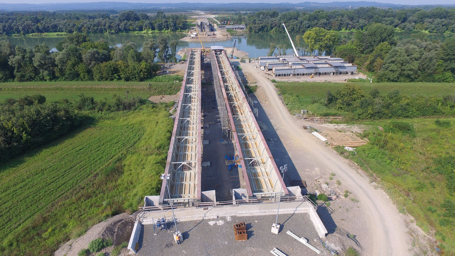
Highway A5: Beli Manastir – Osijek – Svilaj
Sections: Đakovo – Sredanci – BiH border
Total section length: 26 km
Highway A5 forms the north–south axis in eastern Croatia and is part of the international Pan-European Corridor Vc, which connects Budapest via Osijek and Sarajevo to the Port of Ploče on the Adriatic Sea. It is the only Croatian motorway located entirely within the regions of Slavonia and Baranja.
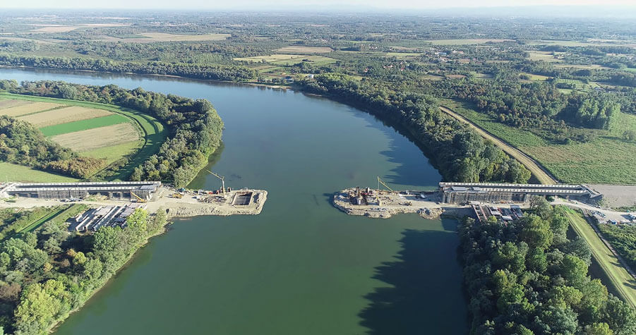
A5 is strategically important for connecting Slavonia and Baranja with the rest of Croatia and for international traffic toward Bosnia and Herzegovina and further to the Adriatic. At its intersection with Highway A3 lies the interregional “Sredanci” interchange, while the most significant structure is the “Svilaj” Bridge over the Sava River on the border with Bosnia and Herzegovina.
CLIENT: Croatian Motorways

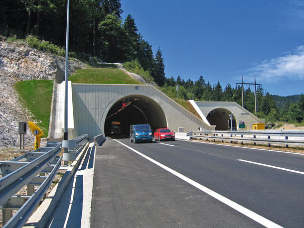
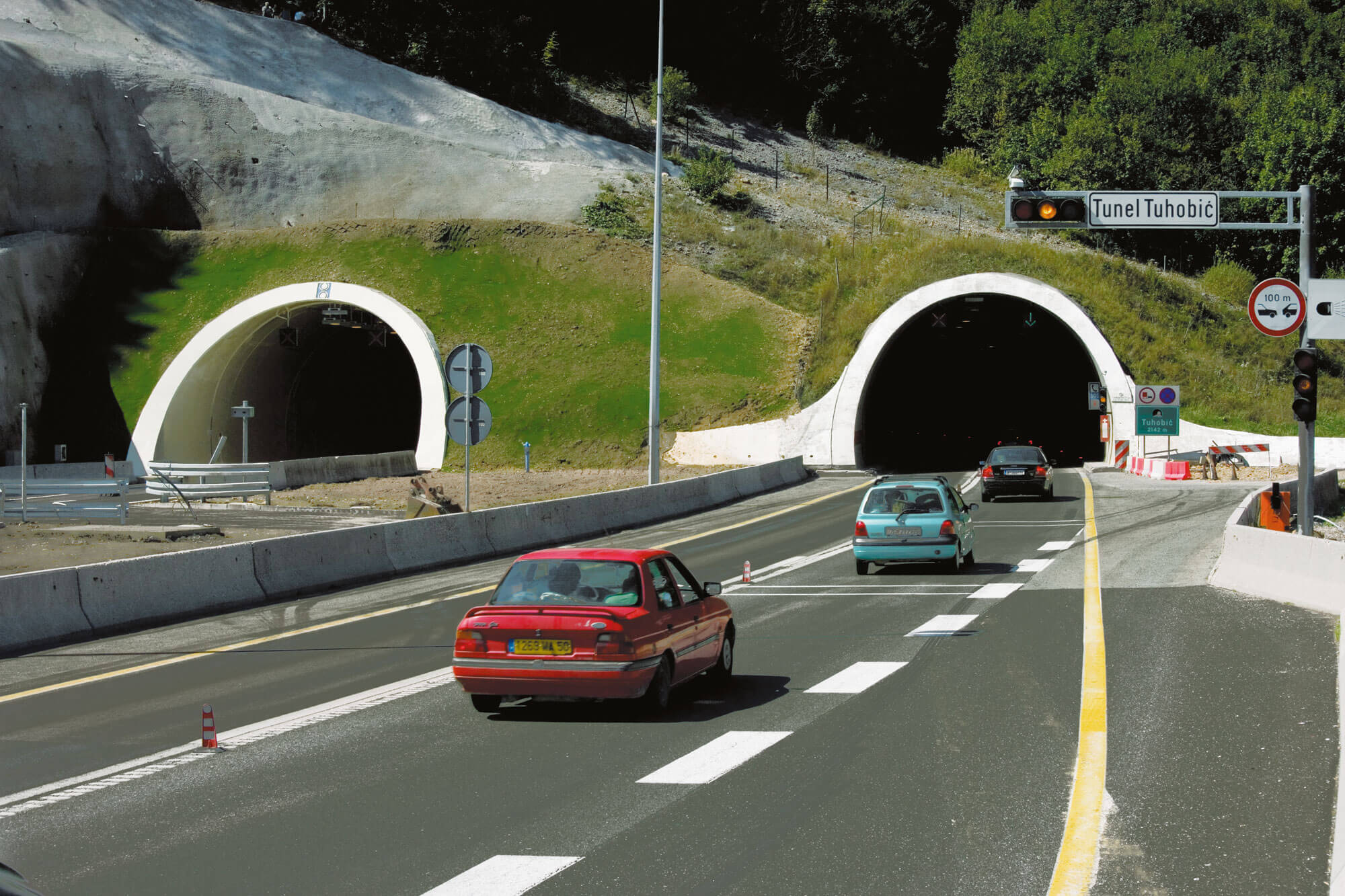
Highway A6: Zagreb - Rijeka
Sections: Bosiljevo – Vrbovsko – Ravna Gora – Delnice - Oštrovica
Total section length: 85 km
Highway A6 is a key transportation route between the Croatian mainland and the Kvarner region. Together with Highway A1, it forms part of the Zagreb – Split – Rijeka Motorway, connecting the capital city with the important Adriatic port of Rijeka. It is also part of the international Pan-European Corridor X and the TEN-T network.
The most significant structures include the “Zečeve Drage” viaduct, “Golubinjak” viaduct, “Hreljin” viaduct, “Bajer” bridge, “Javorova Kosa” tunnel, and “Tuhobić” tunnel.
CLIENT: Croatian Motorways
Highways A8 and A9: Istrian Y
A8 Sections: Rogovići – Kanfanar; Rogovići – Učka Tunnel
Total section length: 45 km
A9 Sections: Buje – Nova Vas – Višnjan; Medaki – Kanfanar
Total section length: 31 km
Highways A8 (eastern branch) and A9 (western branch) form the Istrian Y, the main road network connecting the interior of Istria with the national motorway system of continental Croatia and Slovenia. It enables faster and safer access for tourists from Central Europe, directly contributing to Istria’s economy.
The most significant structures on A8 include the “Mećari” viaduct and the “Gorenja Vas” viaduct, while on A9 they include the “Limska Draga” and “Mirna” viaducts.
CLIENT: Bina Istra
Highway A11: Zagreb - Sisak
Section: Lekenik - Sisak
Total section length: 11 km
Highway A11 provides an important connection between Zagreb and Sisak, linking the capital of central Croatia with the industrial and logistics hub of Sisak-Moslavina County. It connects Sisak to the national motorway network, which is vital for economic and industrial development (refinery, metal industry). It reduces transit traffic through Lekenik and nearby settlements, improving safety on local roads. The motorway also provides faster access to Zagreb and Franjo Tuđman Airport, which benefits both local residents and the regional economy.
CLIENT: Croatian Motorways
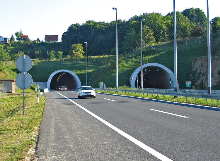
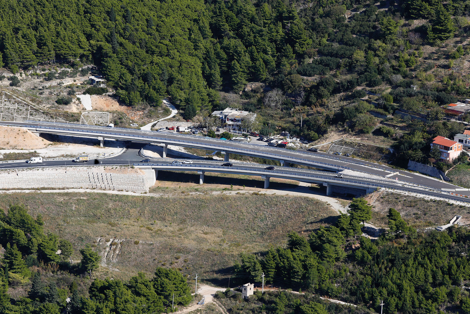
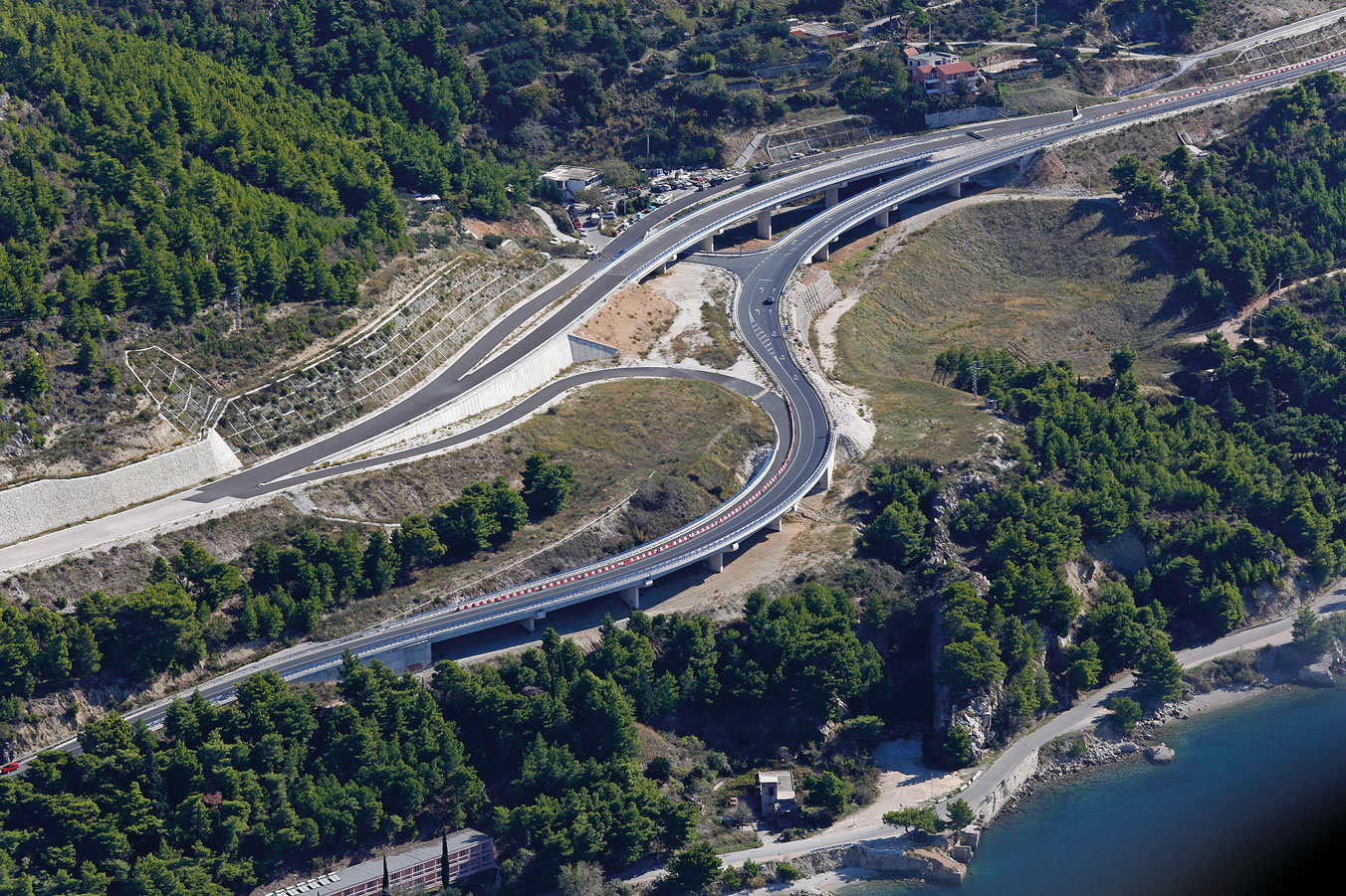
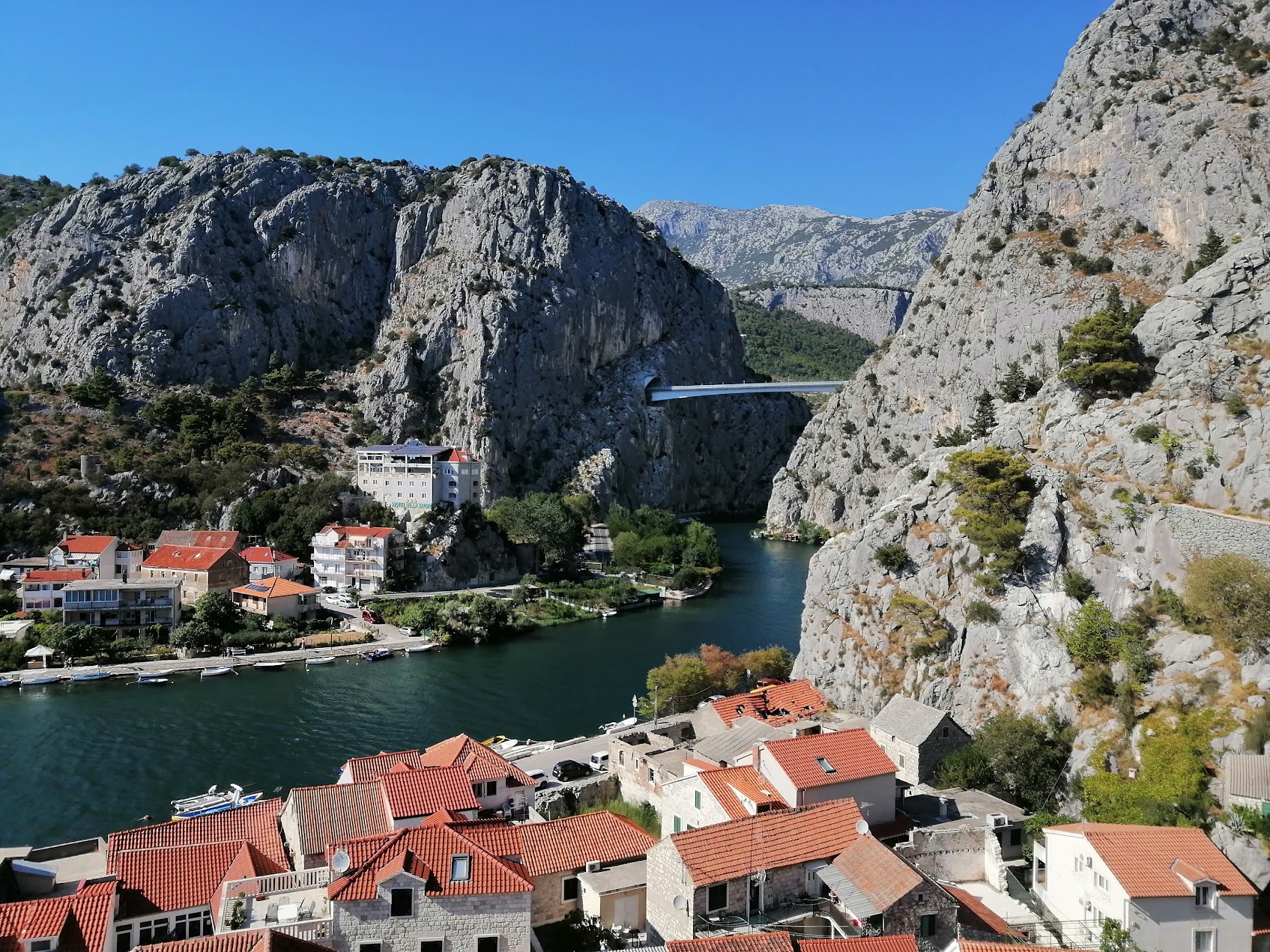
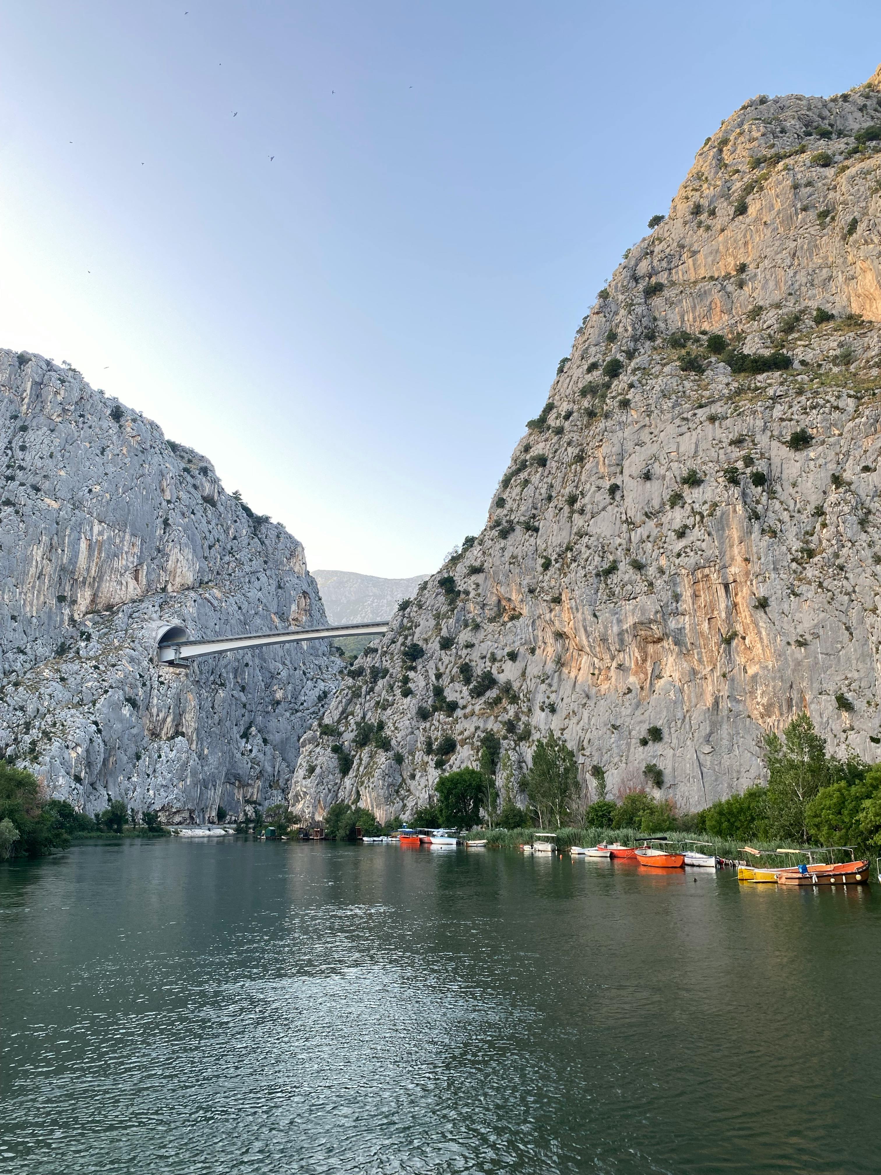
Expressway DC8: Stobreč – Dugi Rat - Omiš
Sections: Dugi Rat - Omiš
Total section length: 10 km
DC8, also known as the Adriatic Highway, is one of the most important coastal roads in Croatia. It is a long traffic axis that connects Dalmatian cities, tourist centers, and islands, serving as an alternative to Highway A1 for local and seasonal traffic. Situated along the Adriatic coast and the Cetina River, the section passes through hilly terrain and karst coastal areas.
The most significant structures include the Cetina Bridge and the Omiš Tunnel.
CLIENT: Croatian Roads
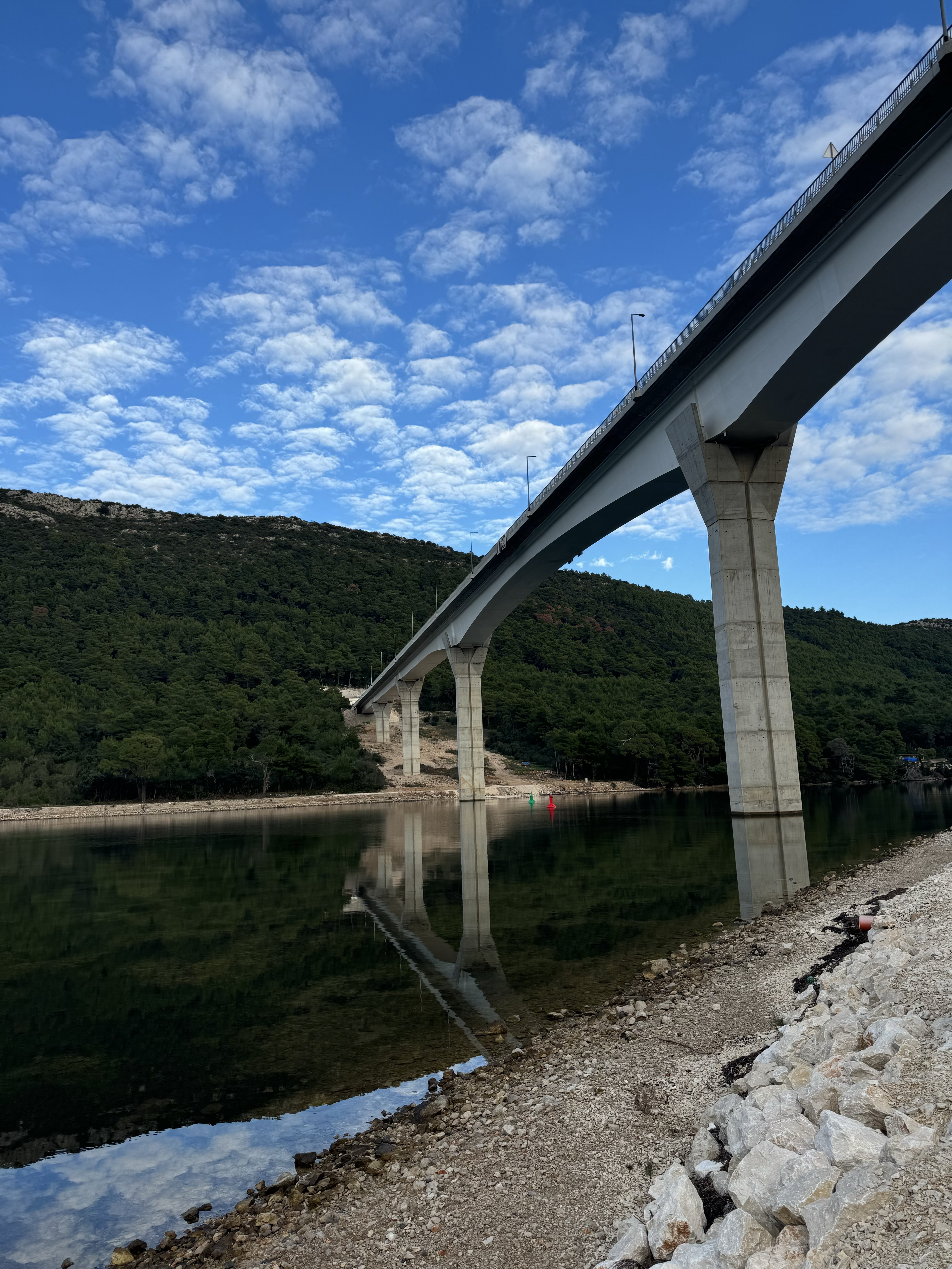
State Road DC414: Sparagovići – Doli on Pelješac
Total section length: 18 km
DC414 is a key road on the Pelješac peninsula, connecting the interior of the peninsula with its central and southern settlements.
It provides safe and efficient traffic for local residents and tourists during the season.
It helps integrate Pelješac into Croatia’s wider transport network, including access to Highway A1 via Ploče, ferry lines to the islands, and continuous road connectivity with Dubrovnik.
The most notable structures are the “Prapratno” viaduct and the “Ston” bridge, as well as the “Polakovica” and “Supava” tunnels.
CLIENT: Croatian Motorways

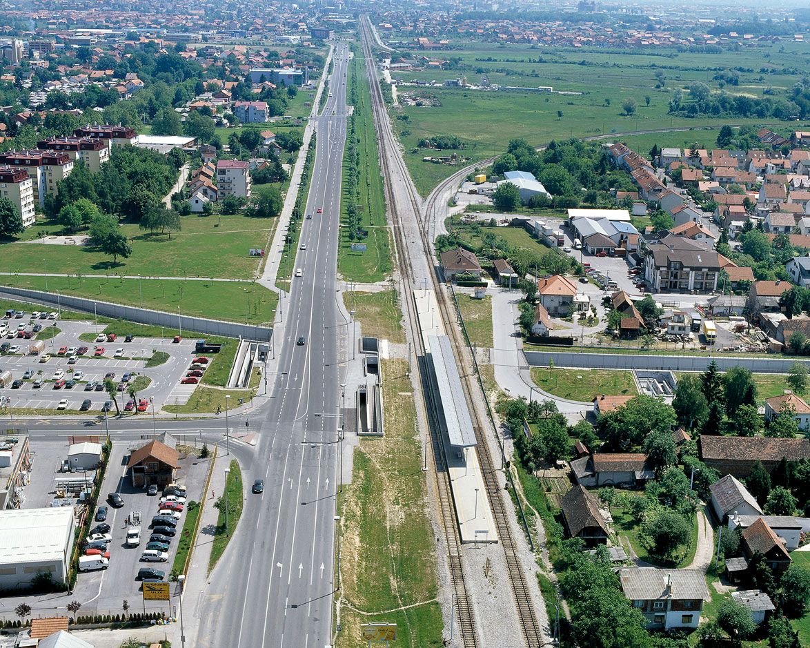
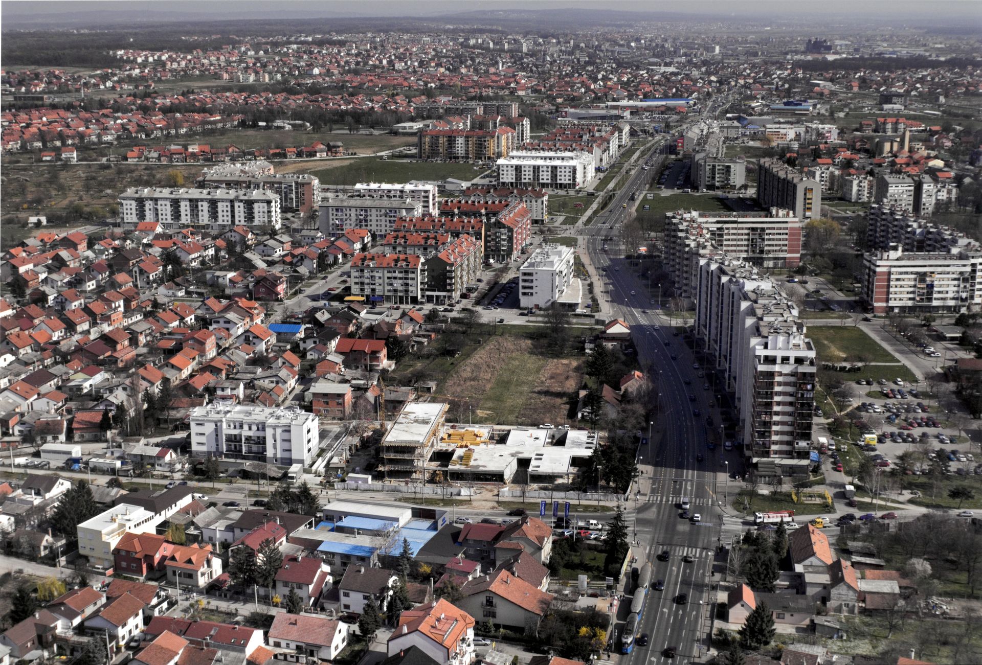
Radnička Road
Radnička Road is one of the main traffic arteries of the City of Zagreb. We had the privilege to completely transform this road over the past two decades, designing several sections from the old Radnička Street to the Homeland Bridge, turning it from a narrow suburban road into one of the city’s most representative avenues. Along the avenue, kilometers of greenery were landscaped, trees were planted, bicycle paths and bus shelters were built, and a tram corridor was provided, completely transforming the view for travelers entering Zagreb from the southeast.
CLIENT: City of Zagreb
Sarajevska Street with Utility Infrastructure and Tram Line
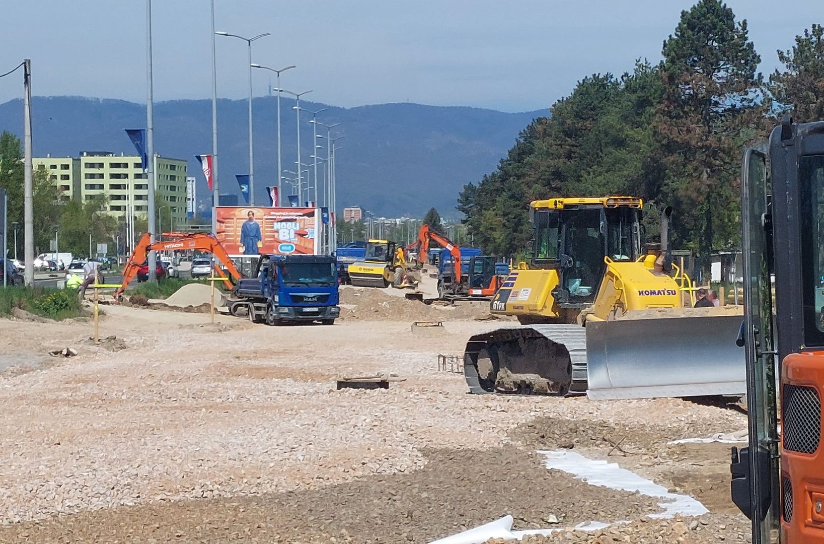
Following the success of Radnička Road, the same approach is now being applied to Sarajevska Street in Zagreb. To ease the existing southern entrance to the city via the Buzin interchange, a “new main entrance” to Zagreb is being built through Sarajevska Street. Upon completion, including the overpass above the Marshalling Yard, this project will establish a direct connection with highways A3, A11, and the city of Velika Gorica, completely reshaping traffic flow in the southern part of the city. The reconstructed Sarajevska Street also includes the complete renewal and upgrade of all utility installations, the introduction of a new tram line, landscaping of green areas, pedestrian and bicycle corridors, improved bus infrastructure, and the construction of noise protection walls.
CLIENT: City of Zagreb
Staro Pračno in Sisak
As part of the 3rd stage of the 1st phase of Highway A11 construction, the project included the preparation of design documentation for the Staro Pračno Roundabout from km 2+650 SC1 to its connection with Zagrebačka Street (at km 0+480 SC2). The documentation covered structures, drainage, canal regulation, traffic signaling, associated installations, landscaping, and noise protection.
By designing a roundabout at the location of the former county road Ž3203 and completing Zagrebačka Street to the standard of an urban avenue, a modern solution was achieved connecting the Zagreb–Sisak motorway access road with the existing road network of Sisak.
CLIENT: Croatian Roads
Extended Rudolf Kolak Street (from Dankovečka to Branimirova)
This strategic city road in Zagreb, together with the extension of Branimirova Street, will form a new transport corridor north of Dubrava Avenue and Zagrebačka Road in Sesvete, helping relieve traffic congestion in the central areas of these districts. It is a new dual-carriageway road that includes pedestrian and bicycle corridors, tree-lined avenues, bus stops, public lighting, and urban equipment.
CLIENT: City of Zagreb
Reconstruction of Dubrava Avenue with New Tram Line
The reconstruction project of Dubrava Avenue included the design documentation for extending the tram line to the Dubec terminus and completely modernized and redefined this key thoroughfare in the northeastern part of the city.
The documentation covered a new 3.9 km tram line, two tram and bus terminals, and the entire roadway with 12 signalized intersections, drainage, public lighting, full pedestrian infrastructure, and underground energy, communication, and water installations.
CLIENT: City of Zagreb
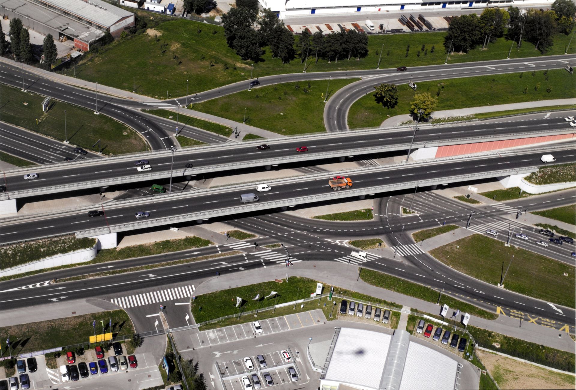
Radnička – Heinzlova Overpass
The project was developed as one of the phases that enabled the construction of Radnička Road, within which a grade-separated intersection of two key city avenues—Slavonska and Radnička—was designed. As part of the grade separation, a double overpass was designed in the east–west direction, together with all associated road infrastructure (carriageways, drainage, all utilities, public lighting, traffic signaling and equipment with signalization, as well as landscaping).
CLIENT: City of Zagreb
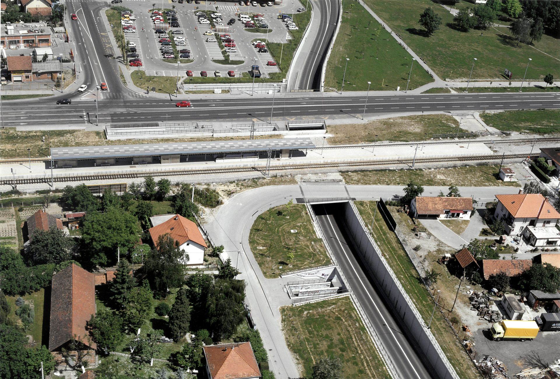
Čulinečka Street with Underpass
As part of the grade separation of the intersection of Čulinečka Street with Branimirova Street and the Zagreb – Slavonski Brod railway line, design documentation was prepared for the long-awaited underpass that runs beneath one of the busiest city roads and the main railway line, significantly reducing congestion in this part of eastern Zagreb.
Within the road projects, multiple signalized intersections were designed, a twin underpass, an upgraded railway station, bus stops, and all associated road infrastructure, including drainage, a pumping station, all electrical and communication installations and corridors, public lighting, traffic signaling and equipment, and landscaping.
CLIENT: City of Zagreb
Slavonska Avenue Underpass beneath Savska Road
The underpass connecting Slavonska and Zagrebačka Avenues beneath Savska Road brought major relief to the most congested part of Zagreb’s road network at the time. As part of the scheme, IPZ reconstructed approximately 1.5 km of Slavonska/Zagrebačka Avenue with connecting ramps and designed a dual-carriageway underpass with a grade-separated section of 700 m and the underpass structure itself over 230 m. Particularly demanding was the foundation of the piers supporting the mainline railway, located at level +1 in the vault zone of the underpass.
Within the road projects, multiple intersections were designed, a dual-carriageway underpass, arranged bus stops, and all associated road infrastructure, including drainage, a pumping station, all electrical and communication installations and corridors, public lighting, traffic signaling and equipment, and landscaping.
CLIENT: City of Zagreb
Extended City of Gospić Street
We are currently working on the Extended City of Gospić Street project, which will significantly relieve traffic in the eastern part of Zagreb by connecting Vukovarska and Mandlova Streets with a main urban road profile. The project includes a grade-separated section—an underpass for two carriageways with a grade separation length of about 590 m and the underpass itself approximately 240 m long.
The road project, which runs along the eastern boundary of the Borongaj Student Campus UPU area, also develops several signalized intersections, a dual-carriageway underpass, pedestrian and bicycle corridors, bus stops, and all associated road infrastructure: drainage, pumping stations, all electrical and communication installations and corridors, public lighting, traffic signaling and equipment, and landscaping.
CLIENT: City of Zagreb
Residential Roads, Neighborhoods, Squares, Paths, and Promenades
Over its long history, IPZ has designed the renovation, reconstruction, and construction of some of the most important city squares, streets, paths, and promenades, as well as roadways for entire residential areas.
- Ilica Street from Ban Josip Jelačić Square to Republic of Austria Street
- Republic of Austria Street along Republic of Austria Square
- Republic of Croatia Square (formerly Marshal Tito Square)
- Kvaternik Square
- Flower Square
- Rastoke Pedestrian Promenade and Bridge (listed among the 54 best tourist villages in the world…)
- Sopnica–Jelkovec Neighborhood
- And many other projects…
Technical documentation for traffic signage and equipment
For all its projects, IPZ d.d., with its team of experts, prepares technical documentation for Traffic Signage and Equipment, Traffic Light Systems for road and tram traffic, Supporting Structures for traffic signage, Road Lighting, Urban Equipment, Electrical Installations and Power Supply for road systems, and Cable Ducting (EKI, DTK).